North Side of Pakistan: Regions, Peaks & Travel Guide
Everything the north side of Pakistan holds: the regions, the five 8,000-metre giants, the famous valleys, and a practical travel guide for 2026.
Quick answer: The north side of Pakistan covers Gilgit-Baltistan and northern KP — K2 (8,611 m), five eight-thousanders, Hunza, Skardu, Fairy Meadows, Deosai and the Karakoram Highway. Best visited April–October.
The regions
The north side of Pakistan has two parts. Gilgit-Baltistan (14 districts) is the high Karakoram-Himalaya country — Gilgit (the capital), Hunza, Nagar, Skardu, Shigar, Khaplu, Astore, Ghizer, Diamer. Northern Khyber Pakhtunkhwa holds Chitral (with the Kalash valleys), Swat, Dir, Kohistan and the Kaghan valley. Three ranges meet here: the Karakoram, the Himalaya and the Hindu Kush — converging near Gilgit at the only triple junction of great ranges on earth.
Peaks and glaciers
- K2 (8,611 m) — world’s second highest; first summited 1954, first winter ascent January 2021.
- Nanga Parbat (8,126 m) — world’s ninth; towers over Fairy Meadows.
- Gasherbrum I (8,080 m), Broad Peak (8,051 m), Gasherbrum II (8,034 m) — the Concordia cluster.
- Baltoro Glacier — one of the longest glaciers outside the poles; the K2 base camp trek follows it.
- Rakaposhi (7,788 m), Tirich Mir (7,708 m) — the great sub-8,000ers of Hunza and Chitral.
Valleys and lakes
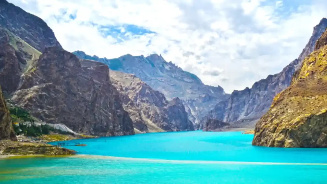
Hunza: Baltit and Altit forts, Attabad Lake (formed by a 2010 landslide), Passu Cones, Hussaini suspension bridge, Eagle’s Nest. Skardu: Shangrila and Upper Kachura lakes, Shigar Fort, Sarfaranga cold desert. Fairy Meadows: the classic Nanga Parbat viewpoint. Deosai: the 4,114-m “Land of Giants” plateau with brown bears. Swat & Kalam: Mahodand Lake, Malam Jabba skiing. Kalash valleys: the unique pre-Islamic Kalasha culture of Chitral. Shandur: the world’s highest polo ground at 3,734 m.
Travel guide: getting there and around
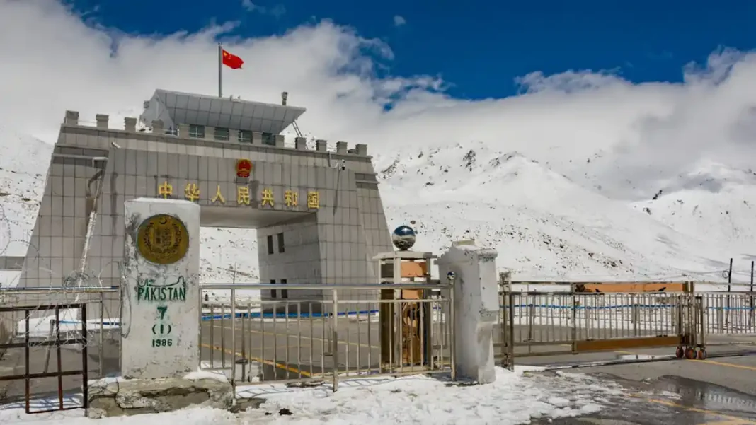
By road: the Karakoram Highway from Islamabad (20+ hours to Gilgit; faster via the Babusar Pass in summer). By air: flights to Gilgit and Skardu — spectacular, but weather-dependent; keep two buffer days. When: April–October (blossoms in spring, trekking in summer, autumn colours in October). Visas: Pakistan’s e-visa and visa-on-arrival cover many nationalities — apply via NADRA ahead of travel. Inside the north: jeeps for Fairy Meadows and Deosai, boats on Attabad Lake, and the Khunjerab day trip from Hunza. Some border areas need permits for foreigners. Costs: a week in Hunza can run from budget guesthouses to luxury resorts; Skardu expeditions cost far more. Safety: GB is Pakistan’s most tourist-friendly region, but mountain weather kills the careless — hire local guides, acclimatise, and never trek alone. For the country across the northern border see which country lies north of Pakistan and the main north Pakistan guide.
Related guides
Frequently asked questions
What is the north side of Pakistan called?
It covers Gilgit-Baltistan and northern Khyber Pakhtunkhwa — the Karakoram, Himalaya and Hindu Kush mountain regions.
What is the most beautiful place in north Pakistan?
Favourites include Hunza Valley (Attabad Lake, Passu Cones), Fairy Meadows (Nanga Parbat view), Skardu and Deosai National Park — each tops different travellers’ lists.
How many days are enough for north Pakistan?
7–10 days for Hunza or Skardu alone; 14 days for a combined Hunza–Skardu–Khunjerab circuit including buffer days for weather.
What is the famous road in north Pakistan?
The Karakoram Highway (1,300 km) — the modern Silk Road from Islamabad to the Khunjerab Pass, often called the Eighth Wonder of the World.