India Map Before Partition: British India in 1947
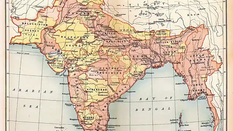
Before the Radcliffe Line, there was no Pakistan or India on the map — only British India: a patchwork of directly-ruled provinces and some 565 princely states stretching from Balochistan to Burma. This is what the map looked like before partition, and how it was divided.
Quick answer: Before partition, the subcontinent was British India — provinces ruled directly from Delhi (Punjab, Bengal, Madras, Bombay, United Provinces…) plus around 565 princely states (Hyderabad, Kashmir, Mysore…). Partition split the provinces and let the states choose.
The British Provinces
British India was administered through provinces ruled directly by the Crown: Madras, Bombay, Bengal, the United Provinces, Punjab, Bihar, the Central Provinces, Assam, the North-West Frontier Province, Orissa, Sindh (separated from Bombay in 1936) and others. These provinces — with elected legislatures under the 1935 Government of India Act — were the units partition would split. See where the line fell in Pakistan map 1947 explained.
The Princely States
Alongside the provinces sat some 565 princely states — from Hyderabad (the largest) and Kashmir to Mysore, Travancore, Bahawalpur, Khairpur, Kalat and hundreds of tiny estates. Ruled by maharajas, nawabs and khans under British “paramountcy”, they were not directly partitioned: each ruler was to accede to India or Pakistan. Most chose by geography and demography; Kashmir, Hyderabad and Junagadh became the famous disputes.
How It Was Divided
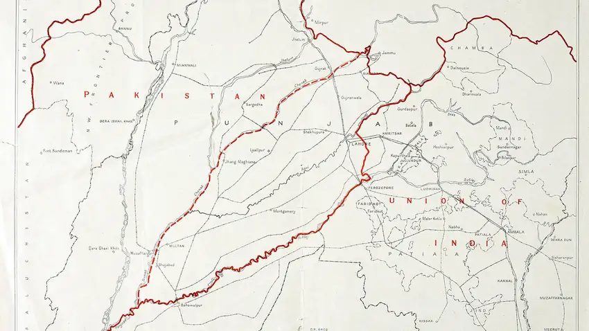
The 3 June 1947 Mountbatten Plan set the formula: Muslim-majority areas would form Pakistan. The Boundary Commissions divided Punjab and Bengal; referendums decided the NWFP and Sylhet; and the princely states acceded individually. The result was the 1947 map of Pakistan — two wings carved from the old empire.
FAQs
How many princely states were there in 1947?
Around 565, covering about two-fifths of the subcontinent’s area and a third of its population.
Which was the largest princely state?
Hyderabad, under the Nizam — larger than many European countries — which acceded to India in 1948.
Did all princely states join India or Pakistan?
Nearly all acceded to one dominion by 1948; Kashmir’s disputed accession led to the first India-Pakistan war and the conflict that continues today.