Pakistan Map 1947: What the Original Map Looked Like and Why
Everyone has seen today’s map of Pakistan. Far fewer have seen the original — the 1947 map with its two wings, its brand-new Radcliffe Line, and borders drawn in five frantic weeks. This is what that map showed, and the story behind every line on it.
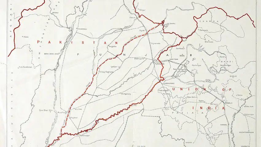
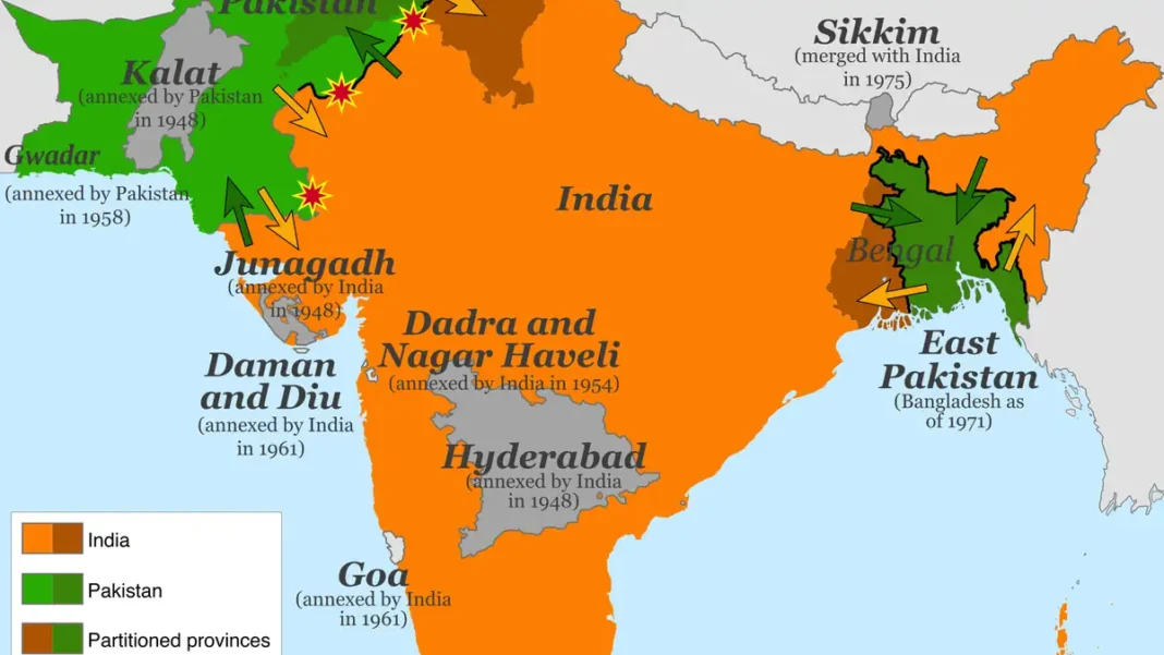
Quick answer: The 1947 Pakistan map showed West Pakistan (today’s Pakistan) and East Pakistan (today’s Bangladesh) as two wings separated by India. The Radcliffe Line, drawn by Sir Cyril Radcliffe in five weeks and published 17 August 1947, split Punjab and Bengal between the two new dominions.
The Two Wings
West Pakistan combined Punjab (western districts), Sindh, the North-West Frontier Province, Balochistan, Bahawalpur state and the tribal areas — with Karachi as the federal capital. East Pakistan combined East Bengal and the Sylhet district of Assam (which voted in a referendum to join Pakistan) — with Dhaka as its capital. Between them lay roughly 1,000 miles of India. Compare with the original map vs Pakistan today.
Who Drew the Line
Sir Cyril Radcliffe, a British lawyer with no South Asia experience, chaired the Punjab and Bengal Boundary Commissions under the 3 June 1947 Mountbatten Plan. Working from the flawed 1941 census with Congress and Muslim League members deadlocked, he drew the line himself in about five weeks, finished around 9–12 August, burned his working papers, and left the subcontinent. The awards were published 17 August 1947 — independence had already been declared on the 14th and 15th. Overview: Pakistan map 1947 hub.
Punjab and Bengal Divided
Both provinces were partitioned: western Punjab and eastern Bengal went to Pakistan; eastern Punjab and western Bengal to India. The division cut through communities, canal systems and cities — Lahore to Pakistan, Amritsar to India, Calcutta to India, Dhaka to Pakistan — and triggered one of history’s largest migrations, with an estimated 1–2 million deaths in the accompanying violence.
FAQs
Why did Pakistan have two wings?
Because the Muslim-majority areas of British India lay at opposite ends — the northwest and the northeast — with Hindu-majority territory between them.
How long did Radcliffe take to draw the border?
About five weeks, from early July to mid-August 1947 — a haste he himself later called absurd.
Was Kashmir part of Pakistan in 1947?
No — Kashmir was a princely state whose ruler’s accession was disputed, triggering the first India-Pakistan war in 1947–48.