


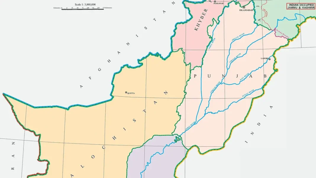
Naksha (نقشہ) is simply the Urdu word for ‘map’ — and ‘Pakistan naksha’ is how millions search for the country’s map. This guide explains the map that matters most: the official political map approved on 4 August 2020, and what makes it different.
Quick answer: Naksha means ‘map’ in Urdu. Pakistan’s official political map was approved on 4 August 2020 and unveiled by PM Imran Khan: it shows the whole of Jammu & Kashmir as disputed (per UN resolutions), includes Siachen, marks Junagadh in Pakistan, and shows the Sir Creek eastern bank — still official in 2026.
In this guide
What ‘Naksha’ Means
نقشہ (naksha/naqsha) = map, chart or plan in Urdu (from Arabic via Persian). Pakistanis searching ‘Pakistan ka naksha’ want the country’s map — political, physical or with cities. This site’s map guides: the definitive Pakistan map guide and map with cities.
The 2020 Official Map
On 4 August 2020, the federal cabinet approved a new official political map, unveiled by Prime Minister Imran Khan — the first redrawing in decades. It was a direct response to India’s 5 August 2019 revocation of Jammu & Kashmir’s special status: Pakistan’s map now asserts its position on every disputed frontier, and it remains the official map in 2026, used in government publications and textbooks.
What Changed
- Kashmir: the entire former princely state shown as disputed, labelled per UN Security Council resolutions
- Siachen: explicitly included, with the LoC’s dotted line running to the Karakoram Pass
- Junagadh & Manavadar: shown within Pakistan (the 1947 accession claim)
- Sir Creek: Pakistan’s claim to the eastern bank marked
- China border: marked ‘Frontier Undecided’ in the west
Naksha in Pakistani Education
Every Pakistani schoolchild learns the naksha early: Pakistan Studies textbooks carry the official political map, and since 2020 they carry the new official map with its Kashmir position. Map-reading — provinces, rivers, neighbours — is examined from primary school through the CSS competitive exams. The 2020 map’s rollout included updating every government-published map in the country, one of the largest cartographic updates in Pakistan’s history.
Naksha in Pakistani Education
Every Pakistani schoolchild learns the naksha early: Pakistan Studies textbooks carry the official political map, and since 2020 they carry the new official map with its Kashmir position. Map-reading — provinces, rivers, neighbours — is examined from primary school through the CSS competitive exams. The 2020 map’s rollout included updating every government-published map in the country, one of the largest cartographic updates in Pakistan’s history.
Frequently Asked Questions
What does naksha mean?
‘Map’ in Urdu (نقشہ). ‘Pakistan ka naksha’ = the map of Pakistan — one of the most searched Urdu-English queries about the country.
Is the 2020 map still official?
Yes — approved 4 August 2020, it remains Pakistan’s official political map as of 2026, used by the government and in textbooks.

: the 2020 official political map — what changed, what it shows, and why it matters. In Urdu and English.)