


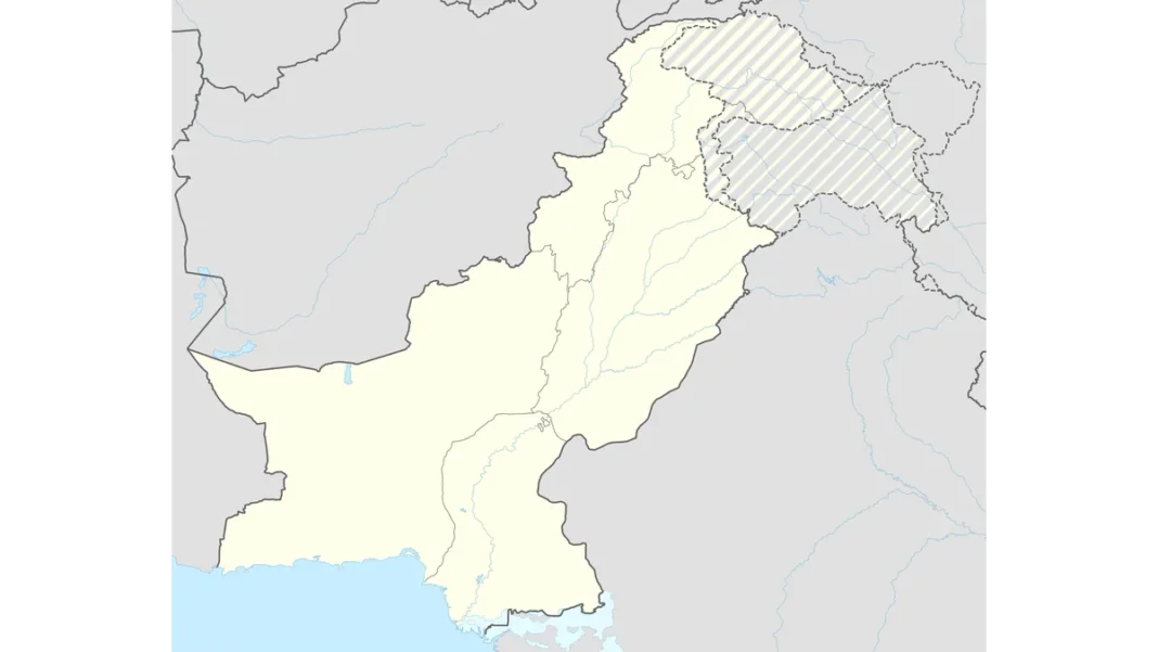
Kashmir map full — the whole disputed territory. Azad Kashmir, Gilgit-Baltistan, and the Indian-held side: every part explained.
Quick answer: Full Kashmir comprises Azad Jammu & Kashmir (~13,297 km², capital Muzaffarabad) and Gilgit-Baltistan (~72,971 km²) on the Pakistani side, and Jammu, the Kashmir Valley and Ladakh on the Indian side. The Line of Control (~740km) divides them. The UN calls these “Pakistan-administered” and “Indian-administered” Kashmir.
The Four Parts of Kashmir
The former princely state of Jammu & Kashmir — the largest princely state of British India — is today divided into four separately administered parts: Azad Jammu & Kashmir and Gilgit-Baltistan (Pakistani side); Jammu & Kashmir and Ladakh (Indian side, reorganised as union territories in 2019). No final settlement has ever been reached; the UNSC resolutions promised a plebiscite that was never held. Three wars (1947–48, 1965, 1971) plus Kargil (1999) were fought over this territory.
The Pakistani Side
Azad Jammu & Kashmir (AJK) — ~13,297 km², a narrow strip 400km long and 15–65km wide, capital Muzaffarabad. Self-governing with its own president, prime minister and legislative assembly (under the 1974 Interim Constitution). Population roughly 4 million. Gilgit-Baltistan (GB) — ~72,971 km², six times AJK’s size, capital Gilgit. The mountain heartland: K2 (8,611m), five of the world’s fourteen 8,000-metre peaks, and three of the longest glaciers outside the poles. GB was the “Northern Areas” until the 2009 Self-Governance Order renamed it; much of its population wants full provincial status. Together the UN terms them “Pakistan-administered Kashmir”.
The Indian Side
Jammu & Kashmir (union territory) — the Kashmir Valley (Srinagar) and Jammu division, administered directly by New Delhi since the 5 August 2019 revocation of Article 370 ended its special constitutional status. Ladakh (union territory) — the high-altitude Buddhist-majority region including Leh, bordering both Pakistan (via the LoC’s northern reaches and Siachen) and China (Aksai Chin, the separate Line of Actual Control). Pakistan’s official term for the whole Indian-held side is “Indian Illegally Occupied Jammu & Kashmir” (IIOJK).
Why the 2019 reorganisation matters on the map: before August 2019, the Indian-held side was a single state (J&K) with special status; after, it became two union territories under direct central rule — a change Pakistan’s 2020 map was drawn to reject. On international maps, the 2019 internal boundary between the two union territories is now shown, adding yet another line to Kashmir’s crowded cartography.
The Divider: The Line of Control
The Line of Control (~740km) separates the Pakistani and Indian-held parts — a military control line, not a legal international boundary. Born as the 1949 ceasefire line (Karachi Agreement), renamed by the Simla Agreement of 2 July 1972. Its northernmost surveyed point is NJ9842; beyond lies the Siachen Glacier, contested since 1984. South of the LoC, the Punjab–Jammu stretch is the “Working Boundary” in Pakistan’s terminology. The LoC’s full story: Line of Control on the map. Pakistan’s official cartography: Pakistan map with Kashmir. The complete guide: Pakistan map with Kashmir: the complete guide.
Kashmir Map: FAQs
What are the parts of Kashmir?
Azad Jammu & Kashmir and Gilgit-Baltistan (Pakistani side); Jammu & Kashmir and Ladakh (Indian side, union territories since 2019).
How big is Azad Kashmir?
~13,297 km² — a narrow 400km strip; capital Muzaffarabad. Gilgit-Baltistan is ~72,971 km².
What divides Pakistani and Indian Kashmir?
The Line of Control (~740km) — a military control line from the 1972 Simla Agreement, not a legal border.
What does the UN call these areas?
“Pakistan-administered Kashmir” and “Indian-administered Kashmir” — deliberately neutral terms.
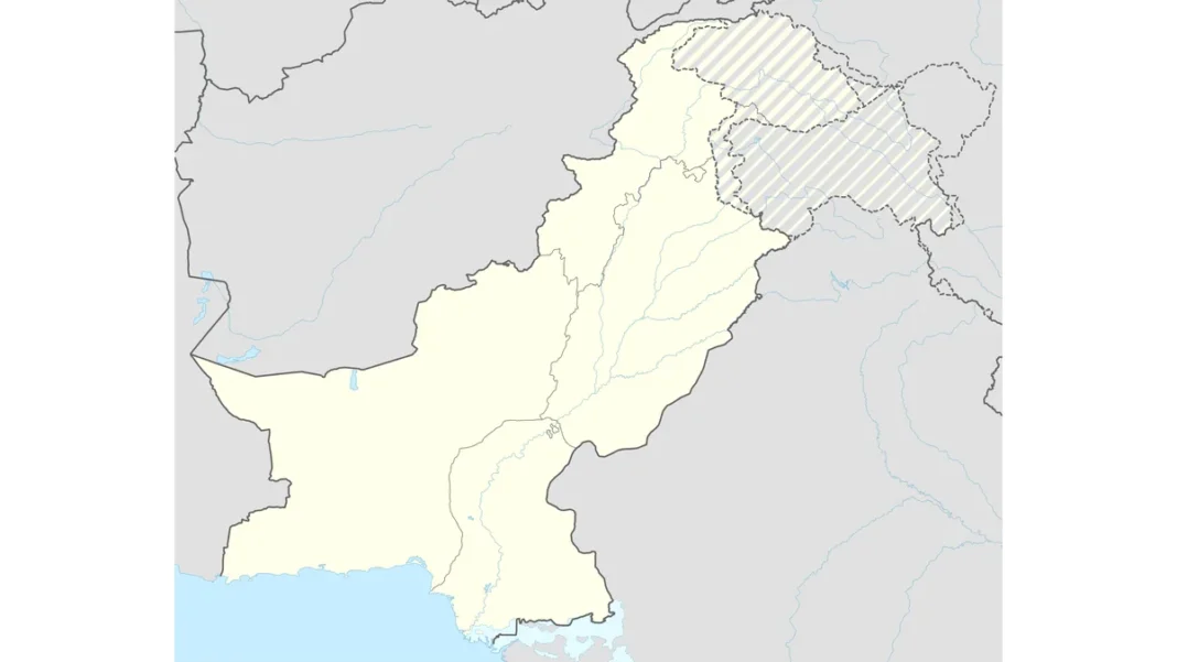
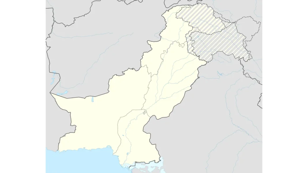
 divides them. 2026 guide.)