Line of Control on map — the ~740km de facto border through Kashmir. Its route, history, and what the line means.
Quick answer: The Line of Control on the map runs ~740km (some sources: 776km) through the former princely state of Jammu & Kashmir — from the Chenab river region to NJ9842, beyond which lies Siachen. It was the 1949 ceasefire line, renamed the LoC by the Simla Agreement (2 July 1972). It is not a legal international boundary — it’s a military control line.
The Route: What the Map Shows
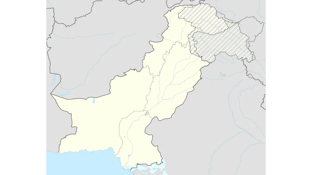
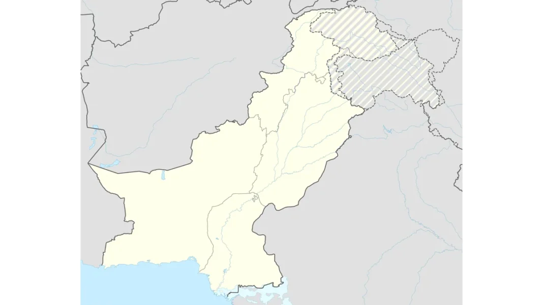
On the map, the LoC snakes ~740km through mountainous terrain: from the Chenab river / Akhnoor sector in the south, winding north through Poonch, Rajouri, Uri and Kupwara sectors, to its northernmost surveyed point NJ9842 — a map grid reference that has become one of the most famous coordinates in South Asia. Beyond NJ9842 the line is undefined: the 1972 delineation stopped there with the words “thence north to the glaciers” — the ambiguity that led to the Siachen conflict from 1984. On international maps the LoC appears as a dashed line; on Pakistan’s 2020 official map it’s a red-dotted line extended to the Karakoram Pass.
History: From Ceasefire Line to LoC
1947–48: the first Kashmir war, after the Maharaja’s accession to India. 1 January 1949: ceasefire; the Karachi Agreement (July 1949) drew the ceasefire line, monitored by UNMOGIP — UN military observers still deployed today, one of the UN’s oldest missions. 1965: the second Kashmir war; the Tashkent Declaration restored the status quo. 1971: the third war; 2 July 1972: the Simla Agreement renamed the ceasefire line the “Line of Control” — with both sides pledging to respect it “without prejudice to the recognised position of either side”. That careful phrase is why the LoC is a control line, not a border: neither side’s claim is settled by it.
What the Line Means
Militarily: one of the world’s most fortified frontiers — fenced, mined in stretches, under constant surveillance, with regular ceasefire violations (a 2003 ceasefire, renewed in 2021, has mostly held since). Legally: nothing is settled — Pakistan calls the whole territory disputed pending the UNSC-promised plebiscite; India calls its side integral. Humanly: the LoC divides villages, families and farmland — divided families meet at designated crossing points (like Chakothi–Uri) under tightly controlled arrangements. South of the LoC proper, the Punjab–Jammu stretch is the “Working Boundary” in Pakistan’s terms (India calls it an international border) — another line that isn’t quite a line.
The LoC Today
The LoC of 2026 is quieter than its history but no less significant. The 2021 ceasefire recommitment has largely held, making the frontier calmer than at any point in decades — though both armies remain deployed in strength. The line’s cartographic future is frozen: Pakistan’s 2020 official map draws it to the Karakoram Pass; international maps keep the dashed ~740km version. For the territory it divides, see Kashmir map full; for Pakistan’s official cartography, Pakistan map with Kashmir and the complete guide.
Line of Control: FAQs
How long is the Line of Control?
~740km (some sources cite 776km) — from the Chenab region to NJ9842.
When was the LoC established?
As the ceasefire line in 1949 (Karachi Agreement); renamed the Line of Control on 2 July 1972 (Simla Agreement).
Is the LoC an international border?
No — it’s a military control line. Neither side’s territorial claim is settled by it.
What is NJ9842?
The northernmost surveyed point of the LoC — beyond it lies the Siachen Glacier, contested since 1984.