Open a Pakistan provinces map and you are looking at one of the most varied administrative landscapes in South Asia — a province larger than most countries next to a capital territory you could drive across in an hour. This guide walks you through every unit on the map: the four provinces, the two autonomous territories and the federal capital, with capitals, areas and populations.
Quick answer: Pakistan has four provinces — Punjab (capital Lahore), Sindh (Karachi), Khyber Pakhtunkhwa (Peshawar) and Balochistan (Quetta) — plus Azad Jammu and Kashmir (Muzaffarabad), Gilgit-Baltistan (Gilgit) and the Islamabad Capital Territory.
In this guide
The Four Provinces
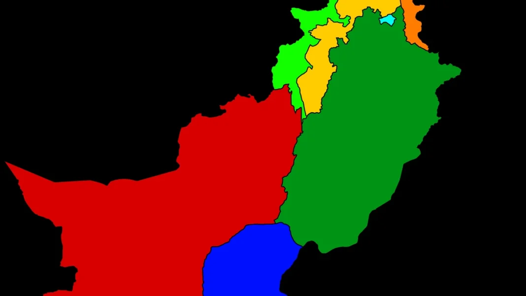
Pakistan’s four provinces are the country’s main federating units, each with its own elected assembly, chief minister and governor. On the map they divide the country into four unmistakable blocks:
| Province | Capital | Area (sq km) | Population (2023 census) |
|---|---|---|---|
| Punjab | Lahore | 205,344 | ~127.7 million |
| Sindh | Karachi | 140,914 | ~55.7 million |
| Khyber Pakhtunkhwa | Peshawar | 101,741 | ~40.9 million |
| Balochistan | Quetta | 347,190 | ~14.9 million |
Punjab dominates the eastern plains — the Indus and its tributaries water the farms that feed the country. Sindh runs from the Arabian Sea up the lower Indus; Karachi, its capital, is Pakistan’s largest city and economic engine. Khyber Pakhtunkhwa covers the north-west, including the former tribal districts merged into the province in 2018. Balochistan takes up about 44% of Pakistan’s land but holds barely 6% of its people — a vast, mineral-rich plateau. For the full provincial breakdown, see our provinces of Pakistan guide.
Territories and the Federal Capital
Beyond the four provinces, the map shows three more units:
- Azad Jammu and Kashmir (capital Muzaffarabad, ~13,297 sq km) — the self-governing territory west of the Line of Control, with its own president, prime minister and legislative assembly.
- Gilgit-Baltistan (capital Gilgit, ~72,971 sq km) — the mountainous north, home to K2 (8,611 m) and four of the world’s fourteen 8,000-metre peaks.
- Islamabad Capital Territory (capital Islamabad, ~906 sq km) — the federal capital enclave, administered directly by the federal government.
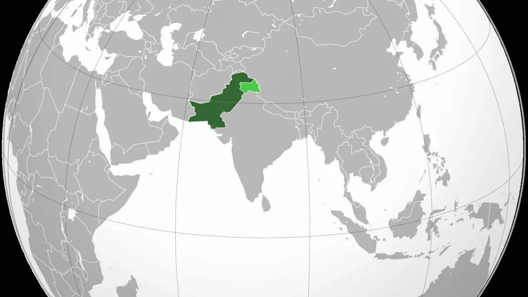
On Pakistan’s official map these appear as integral parts of the country; international maps sometimes shade Kashmir differently to reflect the dispute.
How to Read the Map
A good Pakistan provinces map uses colour to separate the four provinces and different shading or hatching for the territories. Look for three things:
- The Line of Control — the dotted military line dividing Kashmir, running north from near Jammu to the Siachen area.
- The Durand Line — the long western boundary with Afghanistan, cutting through the mountains of Khyber Pakhtunkhwa and Balochistan.
- The Indus — the river that ties the map together, flowing from the northern mountains through Punjab and Sindh to the Arabian Sea.
Note that maps published in India, Pakistan and the West often disagree on Kashmir’s depiction — always check which convention a map follows. Our Pakistan map hub explains the official Pakistani position in detail.
Frequently Asked Questions
What is the largest province of Pakistan?
Balochistan is the largest province by area at about 347,190 sq km — roughly 44% of Pakistan’s total land. By population, Punjab is by far the largest with around 128 million people.
Which province has the most people?
Punjab, with about 127.7 million people in the 2023 census — more than half of Pakistan’s total population of 241.5 million.