


Pakistan Borders: All 4 Neighbouring Countries, Lengths and Border Names
Pakistan shares 6,774 kilometres of land borders with four countries — and each border has its own name, history and crossing points. This guide lists every neighbour, the exact border length, what the border line is called, and the main crossings travellers and traders use.
Quick answer: Pakistan borders India (2,912 km, Radcliffe Line) to the east, Afghanistan (2,430 km, Durand Line) to the northwest, Iran (909 km) to the west and China (523 km) to the northeast — a total of 6,774 km of land borders, plus a 1,046 km Arabian Sea coastline.
In this guide
India — 2,912 km to the East: the Radcliffe Line
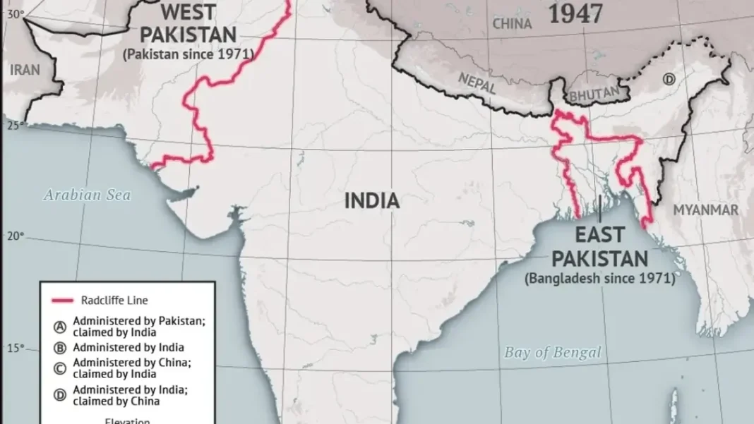
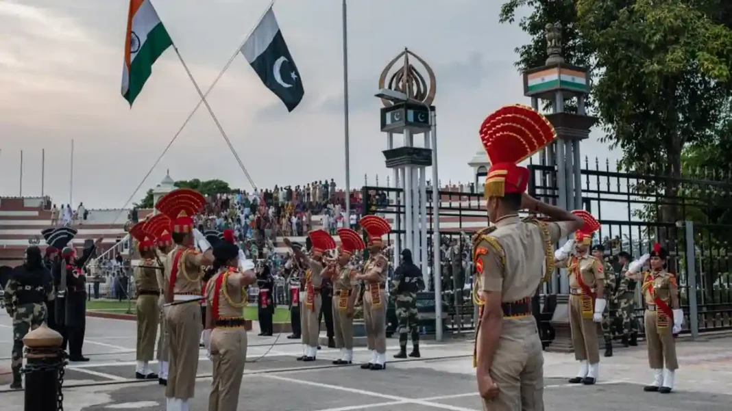
Pakistan’s longest border runs with India along its east and southeast. Drawn in 1947 by British lawyer Cyril Radcliffe during Partition, the Radcliffe Line stretches 2,912 km from the Arabian Sea coast up through Sindh, Punjab and into the disputed Kashmir region. The famous Wagah-Attari crossing near Lahore is the only road border crossing between the two countries, known worldwide for its flag-lowering ceremony. (Wondering which country lies in the east of Pakistan? The full answer is here.)
Afghanistan — 2,430 km to the Northwest: the Durand Line
The Durand Line, agreed in 1893 between British India and Afghanistan, forms Pakistan’s 2,430 km border with Afghanistan along Khyber Pakhtunkhwa and Balochistan. The busiest crossing is Torkham near Peshawar, the historic gateway on the Grand Trunk Road, followed by Chaman in Balochistan. This is Pakistan’s most sensitive frontier and the focus of the ongoing border-fencing programme.
Iran — 909 km to the West
Pakistan’s 909 km border with Iran runs through Balochistan’s deserts. The main crossing is at Taftan, used by pilgrims travelling to Iran and Iraq as well as by freight traffic. The border region is sparsely populated, and both countries have cooperated on fencing and border markets in recent years.
China — 523 km to the Northeast: Khunjerab
The shortest of Pakistan’s borders, 523 km with China, runs through the Karakoram mountains of Gilgit-Baltistan. The Khunjerab Pass (4,693 m) is the world’s highest paved international border crossing and the gateway of the China-Pakistan Economic Corridor (CPEC). It closes in winter due to heavy snow and typically reopens in spring.
Pakistan’s borders at a glance
| Neighbour | Direction | Length | Main crossing |
|---|---|---|---|
| India | East & southeast | 2,912 km | Wagah-Attari |
| Afghanistan | Northwest & north | 2,430 km | Torkham |
| Iran | West | 909 km | Taftan |
| China | Northeast | 523 km | Khunjerab Pass |
Beyond its land borders, Pakistan has a 1,046 km coastline on the Arabian Sea and shares a maritime boundary with Oman. It is separated from Tajikistan only by Afghanistan’s narrow Wakhan Corridor. For the full area picture, see our complete Pakistan area guide.
Related Guides
Frequently Asked Questions
How many countries border Pakistan?
Pakistan shares land borders with four countries: India, Afghanistan, Iran and China. It also has a maritime border with Oman and a 1,046 km coastline on the Arabian Sea.
What is the name of the border between Pakistan and India?
The Pakistan-India border is called the Radcliffe Line, named after Cyril Radcliffe, who drew it during the Partition of British India in 1947. It is 2,912 km long.
What is the name of the border between Pakistan and Afghanistan?
The Pakistan-Afghanistan border is called the Durand Line, agreed in 1893. It is 2,430 km long, and its main crossing is Torkham near Peshawar.
Which is Pakistan’s longest border?
Pakistan’s longest border is with India at 2,912 km, followed by Afghanistan at 2,430 km, Iran at 909 km and China at 523 km.
, Afghanistan (2,430 km), Iran (909 km), China (523 km). Names and crossings.)