Pakistan Relief Map: Mountains, Rivers and Plains in Three Dimensions
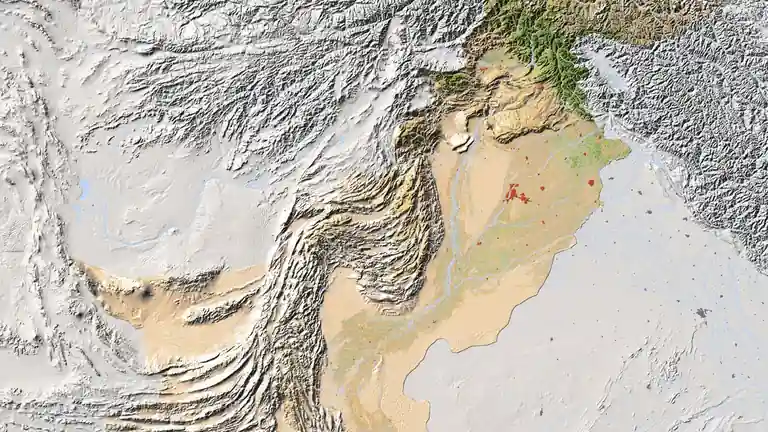
Political maps show who governs where. A Pakistan relief map shows why the country looks the way it does: the great mountain walls of the north, the flat green Indus plain, the high dry plateau of Balochistan. Rendered in shaded 3D terrain, a relief map makes Pakistan’s physical geography intuitive at a glance — this guide explains how to read it region by region.
Quick answer: A Pakistan relief map shows the country’s terrain in shaded 3D: the Karakoram, Himalaya and Hindu Kush ranges (with K2 at 8,611 m) in the north, the Indus river plain through Punjab and Sindh, and the Balochistan plateau in the west. The relief map featured here is our recommended version — study it alongside the political map to understand why Pakistan’s population and cities sit where they do.
In this guide
How to read a relief map
Relief maps use hill-shading: light appears to strike from one side, so ridges glow on one face and shadow on the other, giving a three-dimensional effect. Colour adds elevation — greens for lowlands, yellows and browns for uplands, white for permanent snow. On the featured map, Pakistan’s terrain divides into three unmistakable zones, and once you see them you will never read a flat political map the same way again. Our physical features map of Pakistan goes further into each landform with reading notes.
The northern mountains
The top third of the relief map is a crumpled white-and-grey massif: three of the world’s great ranges — the Karakoram, the Himalayas and the Hindu Kush — converge in Gilgit-Baltistan and northern Khyber Pakhtunkhwa. This is where K2 (8,611 m), the world’s second-highest peak, rises, surrounded by some of the longest glaciers outside the poles. The relief makes clear why the north is sparsely populated and why the Karakoram Highway threads through valleys rather than over ridges. The white snowfields you see here match the white crown on our HD satellite view.
The Indus plain
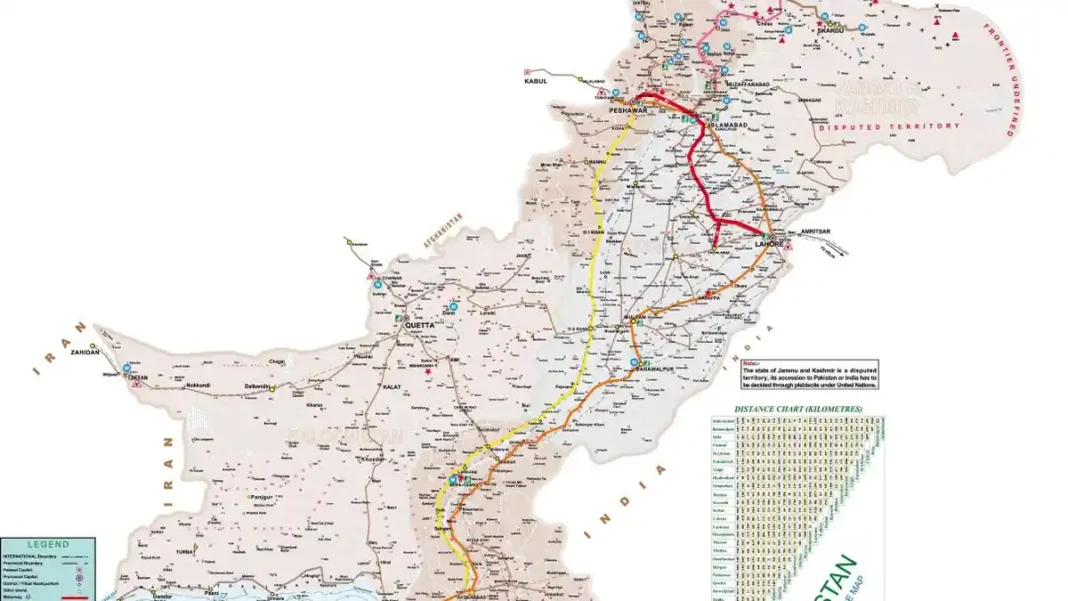
South of the mountains, the terrain flattens abruptly into the great Indus plain — the smooth green-tan wedge covering Punjab and Sindh. The Indus River and its tributaries (the Jhelum, Chenab, Ravi, Beas and Sutlej) have built this plain from millennia of silt, and the relief map shows it as almost perfectly flat: ideal farmland, densely settled, holding Lahore, Faisalabad, Multan, Hyderabad and most of Pakistan’s 240+ million people. The plain’s flatness is also why the motorway network and the Grand Trunk Road run so straight through it — compare with the detailed road map.
The Balochistan plateau
West of the Indus, the land rises again into the Balochistan plateau — a high, arid tableland scored by parallel ridges (the Sulaiman and Kirthar ranges along its eastern edge are clearly visible). The plateau averages 600–900 metres in elevation, gets little rain, and holds barely 6% of Pakistan’s population on 44% of its land. The relief map explains Balochistan’s economy at a glance: mineral-rich, water-poor, with settlement clinging to Quetta’s valley and the coastal strip near Gwadar.
Related Guides
Pakistan relief map: FAQs
What does a relief map of Pakistan show?
The country’s terrain in shaded 3D: the northern mountain ranges, the flat Indus plain, and the Balochistan plateau — with elevation shown through hill-shading and colour.
Where is K2 on the relief map?
In the far north, in the Karakoram range of Gilgit-Baltistan — the highest white peak of the northern massif, at 8,611 metres.
Why is most of Pakistan’s population in the plains?
The Indus plain is flat, fertile, river-watered farmland — ideal for agriculture and settlement. The mountains and the arid plateau are far harder to live and farm in, as the relief map makes obvious.
What is the difference between a relief map and a physical map?
They are closely related: a physical map uses colour for elevation and landforms, while a relief map adds shaded 3D effect. The featured map does both.