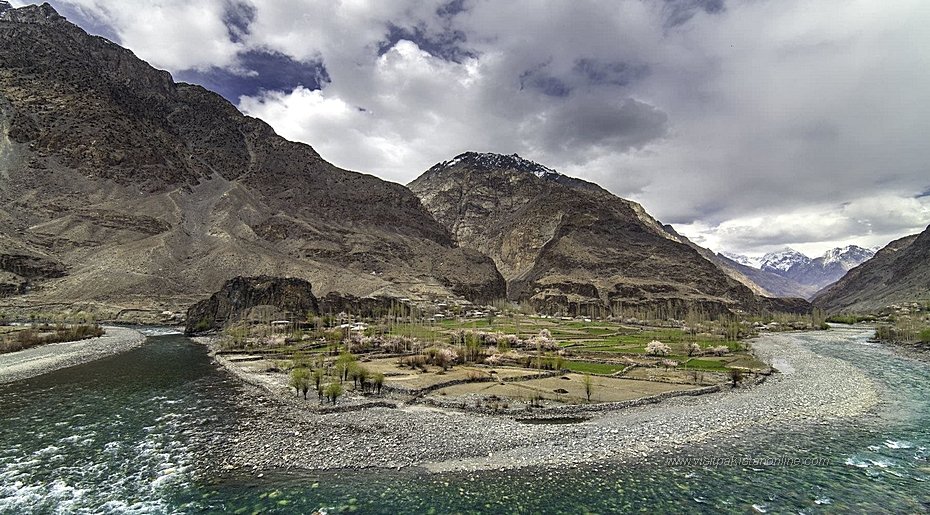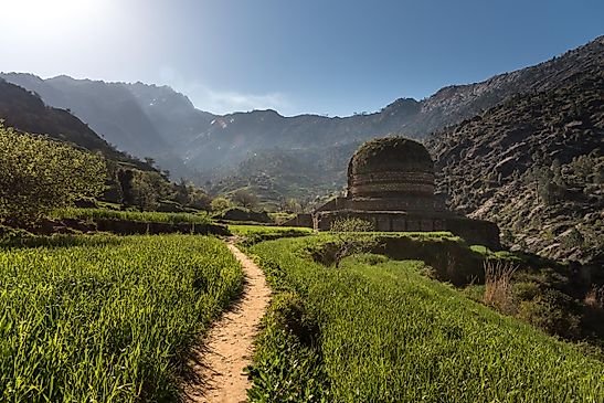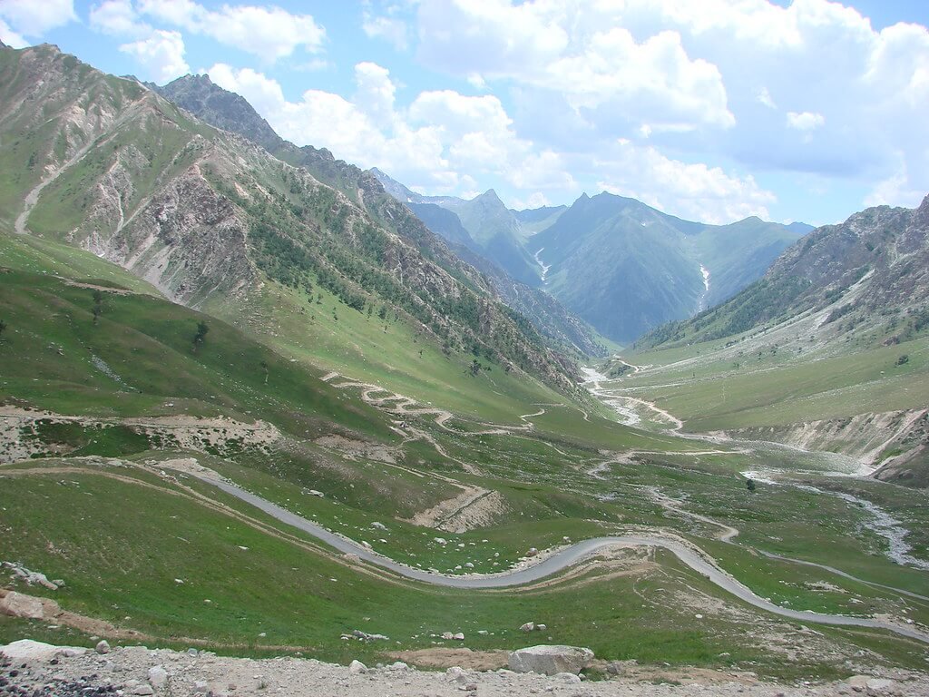
There are mountain passes you cross to get somewhere — and then there are mountain passes you cross to understand somewhere. At 4,100 meters on the old caravan road between Gilgit and Srinagar, Burzil Pass is firmly the second kind. This was the road that linked empires: the route by which mail once traveled between British India and China, the oldest known crossing connecting Gilgit with Skardu and Srinagar across the Deosai Plateau. Today it is a high, wind-scoured saddle of alpine grass and big skies, guarded by the Pakistan Army at Chilam Chowki, leading to some of the most restricted and beautiful country in Gilgit-Baltistan. This burzil pass travel guide gives you everything you need — why this historic pass deserves your trip, when the road opens, and exactly how to reach it.
Quick Facts
- Location: Astore District, Gilgit-Baltistan, Pakistan — on the route from Astore toward Minimarg, near the administrative boundary with Azad Jammu and Kashmir
- Altitude: around 4,100 meters (about 13,500 feet) above sea level
- Famous For: the historic Srinagar–Gilgit caravan route, the source of the Astore River, and its wide alpine crest green in summer
- Nearest City: Astore town (the pass lies beyond Chilam Chowki, about 44 km from Astore plus 18 km to the crest)
- Accessibility: 4×4 jeep road only, open roughly July to September; Minimarg side requires army clearance at Chilam Chowki
- Known Landmarks: the old mail-relay hut site at the crest, Chilam Chowki, Minimarg, and the Astore River’s source
- Best For: adventure travelers, history lovers, photographers, and anyone heading to Minimarg or Rainbow Lake
Why Visit Burzil Pass
Most high passes in Pakistan are famous for a lake or a meadow. Burzil is famous for a story — and it is a story worth the thin air. Stand on the broad crest in July, with alpine grass rippling under a huge sky, and you are standing where centuries of travelers stood before you: merchants on horseback moving between Srinagar and Gilgit, couriers carrying the mail of empires, and the soldiers and surveyors of British India. It is one of the oldest known routes through these mountains, and the silence up here has a weight to it that newer tourist roads cannot match.
The pass is also the key that unlocks the Minimarg side of Astore — some of the most pristine and least-visited country in Gilgit-Baltistan. Beyond Burzil lie Minimarg’s meadows and the famous Rainbow Lake, reached only after clearance at the army check post at Chilam Chowki. Because the area sits close to the Line of Control, it has been spared the crowds: this is frontier travel, with permits, checkpoints, and the feeling that you have genuinely left the ordinary tourist trail behind.
For photographers and 4×4 enthusiasts, the road itself is the attraction. The climb from Chilam Chowki to the crest, the descent toward Minimarg, and the views across the Deosai-facing ridges rank among the great high drives of the north. In summer the crest is wide and green — a startling meadow at 13,500 feet — with the Astore River beginning its long journey to the Indus on the western slopes below you.
This is not a casual day trip, and it does not pretend to be. Burzil Pass is for travelers who want their mountains with history, altitude, and a little adventure — the kind of place you will talk about for years.
History of Burzil Pass
The Burzil Pass is the oldest-known route connecting Gilgit with Skardu and Srinagar by way of the Deosai Plateau, and it has been in use for centuries. Long before modern roads, ancient travelers crossed it extensively on horseback and ponies, moving trade and messages between the Kashmir Valley and the high valleys of what is now Gilgit-Baltistan. The city of Gilgit lies some 367 kilometers from Srinagar by this old road, which ran over Burzil above the northern banks of Wular Lake and through Gurez.
Under British rule, the Burzil route ran freely through the princely state of Jammu and Kashmir. At the beginning of the 20th century, a hut was built on the crest of the pass where couriers delivered mail and messages between British India and China — a relay post on one of the most remote postal routes on earth. Imagine it: riders crossing 13,500 feet of wind and snow to keep the empire’s letters moving.
Everything changed with the First Kashmir War. After the fighting and the establishment of the ceasefire line that divided the former princely state, major sections of the historic route were closed. The pass now lies about 5 kilometers north of the administrative boundary between Gilgit-Baltistan and Azad Jammu and Kashmir, and some 30 kilometers north of the Line of Control — a frontier position that explains both the army presence at Chilam Chowki and the restricted access beyond. The old caravan road to Srinagar is a memory; the road to Minimarg and the Deosai is the living remainder of its story.
Top Things to Do in Burzil Pass
Cross the Historic Crest
The essential experience: the slow, spectacular jeep climb from Chilam Chowki to the 4,100-meter crest, then the descent toward Minimarg. The crest itself is wide and surprisingly gentle, covered in summer with lush alpine grass — a green meadow in the sky. Stop at the top, walk a little, and take in the ridgelines running toward Deosai. This is the roof of the old caravan world, and the views in every direction justify the journey.
See the Source of the Astore River
The Astore River — the lifeblood of Astore Valley, eventually joining the Indus — rises on the western slopes of Burzil Pass. Standing near its infant streams, watching a great river begin as a trickle of snowmelt at 13,500 feet, is one of those quiet travel moments that stays with you. The river drains the Deosai side and winds down through the valley you will drive through on your way up.
Continue to Minimarg and Rainbow Lake
Most travelers cross Burzil as the gateway to Minimarg, one of Gilgit-Baltistan’s most beautiful restricted valleys. From the pass it is about 16 kilometers down to Minimarg village, and from there Rainbow Lake — a jewel of blue water beneath high peaks — is a short drive further. Remember: this side of the pass is a restricted area near the Line of Control. Pakistani tourists need clearance from the army check post at Chilam Chowki; foreign visitors require a special military NOC. Confirm current rules with a registered tour operator before you go.
Photograph the Alpine Summer
In July and August the pass crest is at its most photogenic: green grass, wildflowers, grazing herds, and dramatic cloud shadows racing across the ridges. The light at this altitude is extraordinary — harsh at noon, golden and endless in the evening. Bring spare batteries; the cold drains them faster than you expect.
Visit Chilam Chowki
The army check post settlement at the foot of the pass is where the frontier formalities happen — and where the adventure begins. It is also the junction for Deosai: from the Burzil side, travelers can continue toward the Deosai Plains and Sheosar Lake, making this one of the great crossroads of northern adventure travel.
Famous Places In and Around Burzil Pass
- Minimarg (about 16 km beyond the crest): restricted valley of meadows on the far side, accessible with army clearance
- Rainbow Lake: the famous high lake near Minimarg, known for its vivid blue water
- Chilam Chowki: the army check post and junction below the pass
- Deosai National Park: the vast high plateau reachable from the Burzil side, home to Sheosar Lake and Himalayan brown bears
- Astore town and Rama Meadows: the valley base with its bazaar and the beautiful Rama pine forests
Pair this trip with our Astore travel guide, and browse more northern adventures in the Explore Pakistan collection.
How to Reach Burzil Pass
Reaching Burzil is a proper expedition by road — there is no shortcut and no airport. The pass is approached from Astore town, and the onward road to Minimarg is controlled, so plan your permits as carefully as your route.
Route Details
- Islamabad to Chilas: drive the Karakoram Highway via Mansehra, Naran, and Babusar Top (in summer) or via Besham — a long day of 12 to 16 hours. Alternatively, fly Islamabad to Gilgit (about an hour, weather permitting) and drive back down to the Astore turn-off.
- Chilas to Astore: at the Raikot Bridge area, turn off the Karakoram Highway toward Astore. The road climbs through dramatic gorge country to Astore town and its bazaar — the last proper town before the high country.
- Astore to Chilam Chowki: about 44 kilometers by jeep track into the mountains. This is where you complete the army clearance formalities for Minimarg.
- Chilam Chowki to Burzil Pass: about 18 kilometers of climbing jeep track to the 4,100-meter crest.
- Burzil Pass to Minimarg: about 16 kilometers descending to the valley — only with clearance.
From Islamabad to Minimarg via this route is roughly 530–540 kilometers all told, and it is a two-day journey at minimum — most travelers overnight in Chilas or Astore. From Lahore or Karachi, fly to Islamabad first and join the route from there.
Road conditions and transport: beyond Astore this is 4×4-only territory — hire a jeep with a driver who knows the track; do not attempt it in a normal car. The pass is typically accessible from late June or July through September; outside these months heavy snow closes the crest. The Minimarg side is a restricted area because of its proximity to the Line of Control: expect ID checks, and note that generally only Pakistani tourists are allowed, with foreigners needing special military permission. Rules can change — verify with a registered operator or the local administration before setting out.
Where to Stay in Burzil Pass
There is no accommodation on the pass itself — you sleep below it or beyond it, and every option has the flavor of frontier travel.
Astore town: the practical base. The bazaar area has a spread of hotels and guesthouses from basic to comfortable mid-range, and it is where you will hire your jeep, buy supplies, and finalize your plans. Stay here the night before your crossing.
Chilam Chowki area: very basic lodging exists near the check post for travelers staging an early start — manage your expectations and think of it as a staging post, not a destination.
Minimarg: on the far side of the pass, simple guesthouses and the well-known army mess accommodation serve cleared visitors. Camping is also possible in the meadows around Minimarg and Rainbow Lake in summer — bring full cold-weather gear, as nights at this altitude are freezing even in August. Book or arrange Minimarg stays through your tour operator, since access is controlled.
Deosai side: travelers combining Burzil with Deosai typically camp at Bara Pani or near Sheosar Lake. Again, this is expedition camping: four-season equipment, a stove, and complete self-sufficiency.
Where to Eat: Local Foods of Burzil Pass
At 13,500 feet there are no restaurants — you eat in Astore town before the climb and in Minimarg after it, and the food is classic high-mountain fare. Astore’s kitchens serve the hearty staples of the region: fresh wheat breads, lentils and rice, potato and meat curries, and endless milk tea. Dairy is central to mountain life here — yogurt, butter, and local cheese appear at every meal — and in summer the valleys produce excellent apricots, mulberries, and apples.
Trout from the cold streams of the Astore Valley is the local delicacy; in Astore town’s eateries you can find it simply grilled or fried. For the jeep journey itself, pack like an expedition: dry fruit, nuts, biscuits, and plenty of water from Astore’s bazaar. Meals on this route are simple and budget-friendly — dhabas and guesthouse kitchens charge modest prices — but choice is limited, so travelers with specific dietary needs should carry their own supplies. Above all, eat well before the climb: the body burns serious energy at 4,100 meters.
Weather in Burzil Pass
Burzil at 4,100 meters has an extreme high-altitude climate. Even in midsummer, nights fall below freezing, the wind is relentless, and weather can change in minutes from sunshine to sleet. Winter buries the pass under meters of snow and it stays closed for most of the year. The ranges below are approximate — at this altitude, the only certainty is variability.
| Season | Temperature Range | Conditions |
|---|---|---|
| Winter (Nov–May) | roughly -25°C to -5°C | Pass buried in snow, road closed, extreme wind chill |
| Spring (Jun) | roughly -8°C to 8°C | Snow clearing, road opens late in the month in good years |
| Summer (Jul–Sep) | roughly -5°C to 15°C | Alpine grass green, road open, best and only real visiting season |
| Autumn (Oct) | roughly -15°C to 5°C | First heavy snows, road closes, very short shoulder season |
How is the Burzil Pass weather for travel? Only July through September is realistic. Mid-July onward is considered the sweet spot: the track is clear, the crest is green, and Minimarg beyond is at its best. Even then, carry full winter clothing — at 4,100 meters, summer is a relative term.
Language and Culture of Burzil Pass
The valleys around Burzil speak Shina, the main language of Astore and much of Gilgit-Baltistan’s Diamer division, with Urdu widely understood and English spoken by guides and hoteliers. The culture is that of the mountain communities of Astore — conservative, deeply hospitable, and shaped by altitude and isolation. Minimarg’s meadows carry their own local lore, including the well-known story of the British-era lady “Mini” whose grave gave the valley its name.
Because the far side of the pass is a restricted border area, there is a visible military presence at Chilam Chowki and beyond. Treat checkpoints with calm courtesy: have your ID ready, answer questions plainly, and follow instructions. Photography near military installations is prohibited — ask before raising a camera anywhere near the check posts. In the villages, the usual northern etiquette applies: dress modestly, ask before photographing people, and accept offered tea with good grace.
Shopping in Burzil Pass
Shopping is not the point of Burzil — the pass is a place you cross, not a place you browse. Your supply stop is Astore bazaar, where you can buy dry fruits (apricots, walnuts, and almonds from the valley’s orchards), woolen caps and socks, basic trekking supplies, and snacks for the road. Minimarg has only the most basic shops, so buy everything you need in Astore. For real handicraft shopping — gemstones, woolen shawls, woodwork — do it in Gilgit before heading to Astore. There are no malls, and no souvenir industry, anywhere on the Burzil route.
Travel Tips for Burzil Pass
Packing Essentials
Pack for winter even in July: a down or heavy synthetic jacket, thermal layers, windproof shell, warm hat and gloves, and sturdy boots. The sun at 4,100 meters burns fast — bring strong sunscreen, lip balm, sunglasses, and a hat. Carry a headlamp, a basic first-aid kit, altitude-sickness awareness (headache, nausea, and breathlessness are common above 3,500 meters), and more water and snacks than you think you need. A power bank is essential; there is no charging on the track.
Safety Tips
Altitude is the main risk: ascend gradually, hydrate constantly, and descend if symptoms of altitude sickness worsen. Never drive these tracks at night or in bad weather — landslides and rockfall are real hazards after rain. Hire a local 4×4 driver; the Chilam Chowki–Burzil–Minimarg track is not a place for unfamiliar drivers. Keep your ID on you at all times for the checkpoints, and respect all military restrictions without argument. Let someone reliable know your itinerary and expected return.
Money & Connectivity
Carry all the cash you will need — there are no ATMs beyond Astore town, and none on the pass or in Minimarg. Mobile coverage ends well before the crest; expect no signal from Chilam Chowki onward. Download offline maps, carry a paper backup of your route, and confirm your return transport in advance — you do not want to be stranded at 4,100 meters hoping for a passing jeep.
Best Time to Visit Burzil Pass
Summer (July to September) — the only season
This is it: the road opens, the crest turns green, Minimarg and Rainbow Lake are accessible, and the whole high world is briefly, gloriously open. Mid-July through August is peak — the most reliable weather and the greenest landscapes. September is quieter and still beautiful, but watch the forecasts; early snow can close the pass with little warning.
Late June — the gamble
In a light snow year the track may open in late June, but this is never guaranteed. Only attempt it with current, on-the-ground road information from Astore.
October to May — closed
Forget it. The pass is under deep snow, temperatures are brutal, and the road does not exist for all practical purposes until the summer thaw.
Final Thoughts
Burzil Pass is not the easiest destination in this series, and that is exactly why it matters. In a north that grows busier every year, Burzil remains what the great passes have always been: a threshold. On one side the familiar world of Astore’s bazaars and jeep stands; on the other, restricted valleys, army checkpoints, and some of the most untouched mountain country in Pakistan. Crossing it, you feel the old caravan history in your bones.
Come prepared, come in summer, and come with respect for the altitude and the frontier. The pass will give you green meadows at 13,500 feet, the infant Astore River, and the road to Minimarg — and a story no lakeside selfie can match. For travelers who want their mountains with meaning, Burzil is essential.
FAQs
Where is Burzil Pass located?
Burzil Pass is in Astore District, Gilgit-Baltistan, Pakistan, at about 4,100 meters (13,500 feet). It lies on the route from Astore via Chilam Chowki toward Minimarg, near the boundary with Azad Jammu and Kashmir.
What is the best time to visit Burzil Pass?
July to September, when the snow has cleared and the jeep track is open. Mid-July onward is the most reliable window.
How do I reach Burzil Pass?
Drive from Islamabad to Astore via the Karakoram Highway (through Chilas and the Raikot Bridge turn-off), then take a 4×4 jeep from Astore to Chilam Chowki (44 km) and on to the pass (18 km). Allow two days from Islamabad.
Do I need a permit to cross Burzil Pass to Minimarg?
Yes. The Minimarg side is a restricted area near the Line of Control. Pakistani tourists need clearance at the army check post at Chilam Chowki; foreign visitors generally need a special military NOC. Confirm current rules before traveling.
Is Burzil Pass safe?
The area is peaceful for travelers, with an army presence managing the restricted zone. The main risks are altitude, weather, and the rough track — hire a local driver, carry warm clothing, and follow checkpoint instructions.
What is the altitude of Burzil Pass?
About 4,100 meters (13,500 feet) above sea level. Altitude sickness is possible — ascend gradually and stay hydrated.
Can I see Rainbow Lake from Burzil Pass?
Rainbow Lake is beyond the pass near Minimarg, about 16 km from the crest plus a short drive from Minimarg village. You need the same army clearance to visit it.
Is Burzil Pass suitable for families?
It suits adventurous families with older children who can handle long jeep rides and high altitude. It is not ideal for small children, elderly travelers with health issues, or anyone uncomfortable on rough mountain tracks.