

Punjab Crop Fires Outpace Indian Punjab 4.2 Times
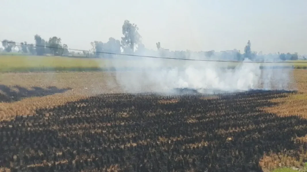
Punjab crop fires detected by satellite in Pakistan’s Punjab were 4.2 times higher than in Indian Punjab during the first 29 days of October 2026, according to an analysis of Nasa satellite data. The gap comes as Lahore faces another spell of thick smog, with the city’s air ranked the worst among major world cities on Friday afternoon.
Dawn reported the findings from environmental monitoring website HamariHawa, which used Nasa’s Fire Information for Resource Management System (FIRMS). Satellites picked up 13,241 fire spots in Pakistan’s Punjab between 1 October and 29 October, against 3,158 in Indian Punjab. The figures come from VIIRS instruments aboard the Suomi NPP, NOAA-20 and NOAA-21 satellites. HamariHawa found that 92 per cent of the fire spots in Pakistan’s Punjab sat on farmland and were likely linked to crop burning.
What the Punjab crop fires data shows
Burning picked up pace late in the month. About half of the monthly total, 6,655 fire spots, appeared in the last seven days, and 29 October was the busiest day, with 1,327. A narrower check using only the Suomi NPP satellite counted 4,562 fire spots in Pakistan’s Punjab and 918 in Indian Punjab.
The pattern is a sharp reversal from 2019. In that year, Indian Punjab recorded almost five times as many fire detections as Pakistan’s Punjab in the same period, with 14,002 against 2,908.
Since then the two sides have moved in opposite directions. Indian Punjab cut its satellite-detected crop fires by 95 per cent between 2021 and 2025, while detections in Pakistan’s Punjab rose by 33 per cent between 2019 and 2025. In 2025, Pakistan’s Punjab recorded 12,364 fire spots against 3,714 in Indian Punjab, or 3.3 times as many.
Where the fires are concentrated
The fires are centred on the rice-growing belt around Lahore. Okara recorded the highest count, with 2,144 fire spots between 1 October and 29 October. Gujranwala followed with 1,011, and Nankana Sahib with 1,003.
Those three districts alone recorded 4,158 fire spots, more than the whole of Indian Punjab in the same period.
| District | Fire spots, 1-29 October 2026 |
|---|---|
| Okara | 2,144 |
| Gujranwala | 1,011 |
| Nankana Sahib | 1,003 |
| Pakpattan | 922 |
| Sheikhupura | 756 |
| Hafizabad | 713 |
| Dera Ghazi Khan | 710 |
| Kasur | 699 |
| Khanewal | 682 |
| Jhang | 676 |
Because these districts ring Lahore, smoke from fires across the province can drift into the city, depending on wind direction. That link matters for Lahore’s residents, who are already living through the smog season. Lahore was earlier ranked the world’s most polluted city, and smog returned to the city as air quality worsened this month. Swiss monitoring platform IQAir put Lahore’s Air Quality Index at 232 at 1pm on 31 October, the highest among major cities and in the very unhealthy range.
How Punjab is responding
The Punjab Environment Protection Agency has stepped up its pre-smog enforcement drive. Official figures for 28 September to 27 October show teams inspected 11,580 brick kilns, demolished 197 non-compliant kilns, sealed 163 units and registered 162 cases, with fines of Rs40.7 million. In industry, 6,650 units were inspected, 22 demolished and 191 sealed, with 333 smog notices, 15 cases and fines of Rs28 million. Plastic burning drew 6,064 inspections, 152 sealed sites and 45,100 kilogrammes of plastic confiscated.
For farm fires, the province has deployed 67 Quick Response Units that use satellite fire detection and field checks to reach hotspots, put out fires and act against those responsible. Drones, night squads and field teams are also tracking pollution sources, and anti-smog guns are running at selected spots in Lahore.
Why the numbers need care
Frequently asked questions
How many Punjab crop fires were detected in October 2026?
Satellites detected 13,241 fire spots in Pakistan’s Punjab between 1 October and 29 October 2026, compared with 3,158 in Indian Punjab.
Which district recorded the most crop fires?
Okara recorded the most, with 2,144 fire spots, followed by Gujranwala with 1,011 and Nankana Sahib with 1,003.
Why does crop burning affect Lahore’s air?
The worst-affected districts lie in the rice-growing belt around Lahore, so smoke can drift into the city depending on wind direction.
Do satellite detections measure how much land was burnt?
No. A detection records a fire at the time a satellite passed overhead. It does not measure the area burnt or smoke produced.
What action is Punjab taking against farm fires?
Punjab has deployed 67 Quick Response Units that use satellite detection and field monitoring to reach hotspots and act against those responsible.